Project Question and Answers
Why wasn’t a roundabout considered for this intersection?
This was a multi-jurisdictional project carried out in collaboration with the Ministry of Transportation and Transit and Westbank First Nation. In consultation with Westbank First Nation, all proposed improvements were required to remain within existing road dedications on Westbank First Nation land due to prolonged timelines associated with Certificate of Possession (CP) land holder transfers. The City’s design consultant explored a roundabout option with an alignment solely on City-owned land; however, this option resulted in significant property impacts and extensive utility relocations, ultimately making the roundabout option unfeasible.
Why was the intersection fully closed?
With significant utility work included in the project scope (City watermain, Westbank First Nation watermain, storm infrastructure, shallow utilities, streetlighting), the full closure allowed construction crews to work more efficiency, ultimately helping to reduce the overall project schedule and keeping the project on budget.
Why did this project start in mid-June 2025?
This was a multi-jurisdictional project carried out in collaboration with the Ministry of Transportation and Transit and Westbank First Nation which required extra coordination. The construction project started in June 2025 due to the way the funding and procurement process unfolded. While we had initially anticipated project funding from the Ministry of Transportation and Transit (MOTT) to be confirmed in April or May, we received early approval in January. This allowed our design team to fast-track the bidding process, with the construction tender issued in March and closing at the end of April. The contract was awarded on May 14 to BC General Contracting Inc., the sole bidder, who proposed a mid-June start based on their existing project commitments.
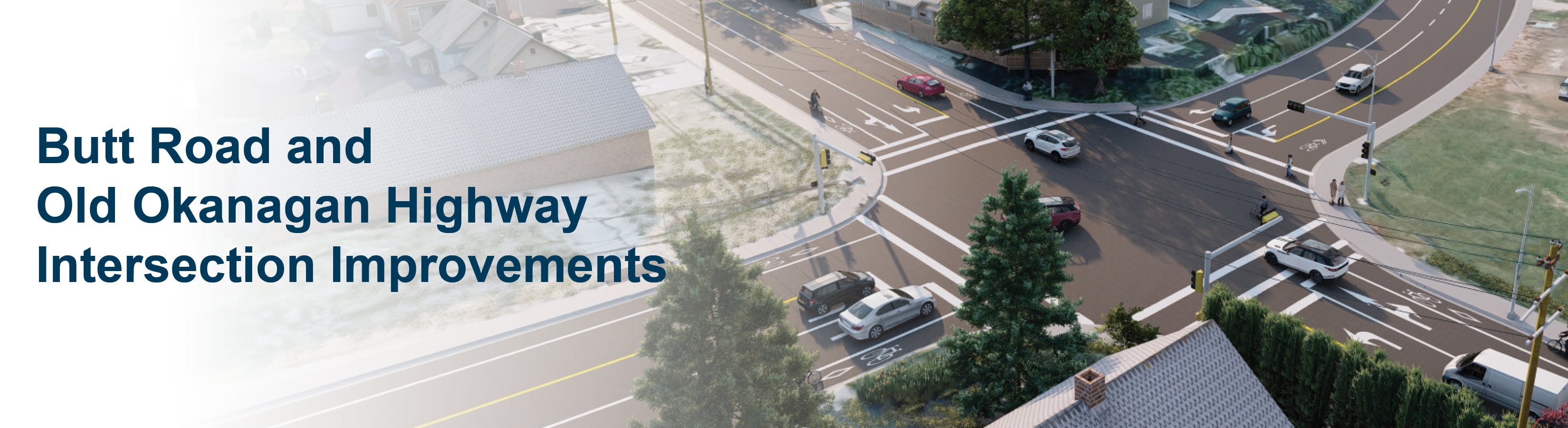
The traffic lights shown in the project rendering looked different from the current ones. Were new traffic lights installed at this intersection?
The traffic signal masts and arms needed to be relocated due to the wider intersection but the traffic signal heads (lights) were re-used to save on costs.
The detour routes were expected to be heavily congested. What traffic management or calming measures were implemented?
Detour and speed limit signage was installed along all detour routes. Traffic control personnel and City staff continuously monitored the routes to ensure public safety and compliance. Traffic control measures were adjusted as needed.
The section of Old Okanagan Highway leading to Shannon Lake Road is in poor condition. Will this road be upgraded as part of the project?
The segment of Old Okanagan Highway from the Butt Road intersection to the Westbank First Nation boundary near Reece Road was identified for asphalt resurfacing in the City’s pavement management plan. The intention was to include this work as part of the overall project.
Given West Kelowna’s history of summer wildfires, what would have happened to the project if an evacuation was required for a nearby neighbourhood?
In the event of an emergency, the contractor would have been required to restore the road and intersection to a drivable condition and open all traffic lanes to facilitate an evacuation. Emergency personnel would have assisted with traffic control.
Were trees along Butt Road and Old Okanagan Highway removed as part of the project?
We understood how difficult it could be for our community to lose trees along Butt Road and Old Okanagan Highway, but they did need to be removed as part of the project to accommodate major road widening, as the improvements for the intersection included additional left-turn lanes in all directions with permissive left-turns and a new westbound right-turn lane on Butt Road. Other trees were planted in 2025 in parks throughout the City.